Don’t worry folks – the sand is safe

On Friday, a long-anticipated storm began to roll across North Dakota from the west. By mid-day no travel was advised in the west as freezing rain and icy conditions made travel very treacherous. It’s not as if we couldn’t see last night’s ice-fest coming.

Imagine my surprise at 5 o’clock when the city’s streets, rapidly turning into an ice skating rink as the temperature dropped, were completely devoid of sand. I drove carefully across town via some of the city’s busiest intersections, but didn’t see any sand spread around.

That’s ironic, because during the summer the city of Bismarck has no problem spreading acres of chip-seal gravel, much of it unmarked, to coat the roads while simultaneously maiming motorcyclists caught unaware. While they’re quite liberal with the pea gravel, each year we end up with a day or so of fender benders that could have been avoided before someone snaps to and orders out the spreader trucks.

This year is no different. In what was perhaps one of the most easily foreseeable freezing rain and ice events, Bismarck residents were forced to tip-toe and white-knuckle their way home on streets that could have been sanded in advance. Once the rain began to fall early in the day, with cold weather approaching and hundreds of miles of iced-up roads in its wake, the city of Bismarck apparently did NOTHING.

By the way, you may have noticed from all the out of state license plates that many drivers on North Dakota roads this year are not North Dakotans. Many come from southern states where they apparently can’t even drive in RAIN, much less snow or glare ice. Now they’re getting a taste of winter and we’re out there playing bumper cars with ’em. I wonder if anyone considered that before opting to wait with winter road preparations?

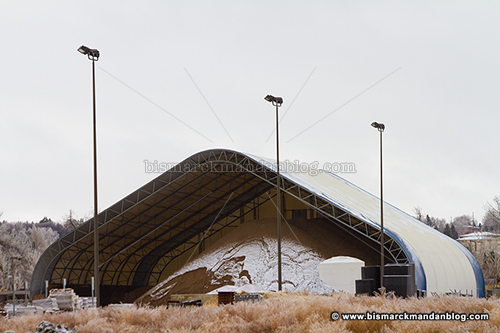
Where’s the sand? Well, don’t worry, folks – it’s sitting safe and sound at the Public Works building. On an errand today I drove past and grabbed the camera to illustrate that as far as sand goes, we’ve got plenty. Unfortunately, even as they begin to load trucks today, it’s going to be spread on Bismarck’s roads at least a day late.

If the city put as much effort into sanding and plowing winter roads in a timely manner as they did trying to soak us for a $90 million Civic Center addition, perhaps we wouldn’t have such dangerous conditions when we’re simply trying to get to/from work and home safely.

Where nature keeps its stuff

Walking along the Lewis & Clark recreational trail this fall I came upon a fallen log with a very large crack down its length. As luck would have it, this made a perfect shelf for leaves and other detritus to accumulate. The log was even oriented in such a way as to make it perfectly aligned. Hopefully within a few days it’ll be full of snow!

Couple of capitol closeups

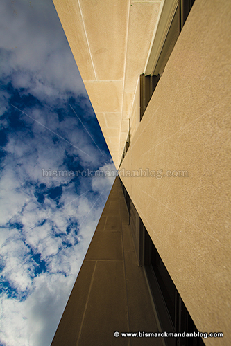
I didn’t get to take part in the Bismarck-Mandan part of the Worldwide Photo Walk event last weekend due to an emergency, but I was able to head over there a few days earlier for a “Photo a Day” project in which I’m taking part sporadically. The theme was “something close-up”, which explains the alliterative title of this post.

The shot above is actually quite pleasing because it was unattainable by the general public all summer long; the scaffolding and surrounding safety fence were only removed from the capitol over the first weekend in October. This is my first close-up shot of the capitol with its newly scrubbed limestone exterior.

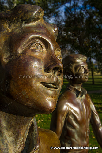
This is Becky (I had to give her a name), the statue near the veterans’ memorial south of the state library and heritage center. I tried a close-up of the dude, but his ear was full of spider webs. Creepy.

My friend Jo got a shot at the capitol that really baked my noodle, so i had to drive to the capitol today and poke around trying to figure out how she got it. I finally figured it out, but not until AFTER leaving the capitol grounds and the possibility of trying it to see if I was correct. I drove there over my lunch hour so perhaps I’ll have to take another crack at it before the weather goes completely medieval on us.

Fox Island Friday. Feedback?

y gracious wife didn’t mind if I took “the scenic route” home from work last night, which was a real blessing. It’s been a LONG time since I’ve been able to do my trademark “just drive around and find stuff to photograph” thing that I love so much, and every little bit helps. I took a couple of interesting shots for the subject “close up” as part of a “Photo a Day” activity that I’m doing, then found myself at Fox Island.

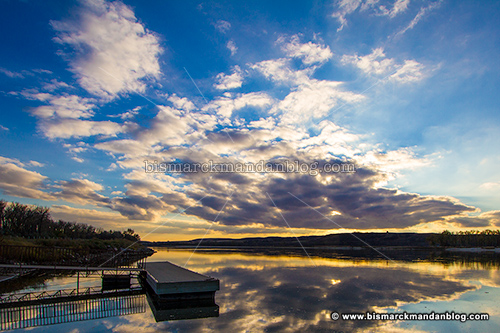
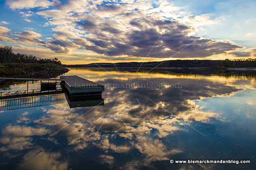
The combination of dramatic clouds overhead and a perfectly calm Missouri River made for ample photographic opportunity. The river, smooth as glass on this rare occasion, made for a great reflection of the clouds overhead. But I’m a stickler for an interesting foreground object, so I worked the scene a little more.

The little dock near the boat ramp served as an interesting feature, jutting into the shot from the left. Its location was pretty good for my purposes but I still couldn’t find a good way to compose my shot with it where I wanted it while still getting the clouds and their atery reflection.

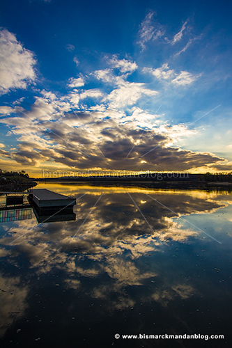
My solution for this was my solution for a lot of things in the 80s and 90s: go vertical. Since I couldn’t get close enough to the dock to keep it more prominent, it loses a little…but that’s why we take multiple exposures I guess.

I started out with my favorite shot being the vertical because I was able to fit in everything I wanted, especially the reflection. Arranging them for this post, however, I actually began liking the second one the best. Again, it comes down to an interesting foreground object. The dock just isn’t prominent enough in the vertical shot since I couldn’t get closer to it. Maybe if I cropped it differently to retain more of the reflections instead of the clouds:

You know, this just doesn’t do it for me either. There’s something about the propertions that just doesn’t seem harmonious to me. I think I’m going to have to focus less on the reflections, regardless of how great a catch they were, and stick by my choice of photo number two. As always, I welcome any feedback. Have a good weekend!

Off duty at 22,000

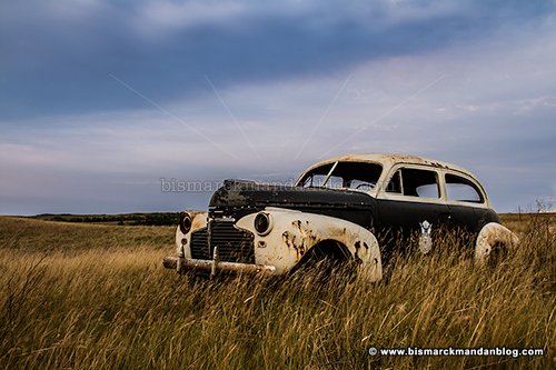
This is my 22,000th photo through my newest camera. The subject is something that has drawn my eye every time I pass it on I-94 near Sweet Briar. Over the extended weekend I decided to venture out at sunrise and, since I’ve photographed all the obvious stuff in Bismarck-Mandan ad nauseum, I needed to travel a little further and get this shot from my photographic “bucket list.”

This is an old police/security vehicle sitting alongside a little gravel road along the interstate highway. While it has a reflective Air Force Security logo sticker on the door, I don’t think that’s original. The car is not directly accessible from there; one has to hit a couple of gravel roads to find it. That’s easily accomplished with a little GPS or Google Earth.

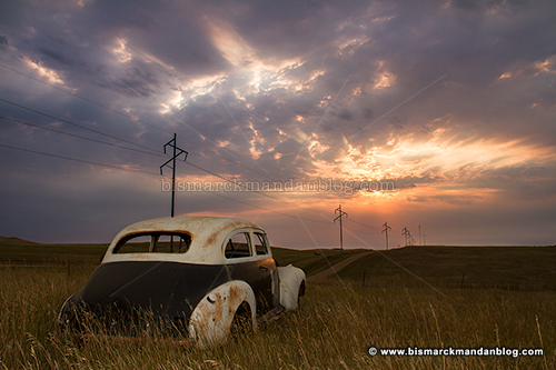
The clouds mostly obscured the sunrise until the sun had come up quite a ways. That actually provided a nice photo opportunity of the car, since I didn’t have to deal with any blazing highlights or deep shadows. Clouds are a great natural diffuser of light. I turned around to capture the sun poking through, although I didn’t care much for the power lines (see yesterday’s post).

Once the golden cast of the sunrise faded, some nice dramatic blues remained. That allowed me one more angle before moving on. People sometimes ask me how I have time to grab all the photos I post on here from day to day. The answer is, quite simply: I don’t. I maximize the photo opportunities that I do get, and then post the photos over time. One photo trip can sometimes provide a week’s worth of blog material if it’s a productive one. In this case, yes, I did find some other fun stuff…and yes, it will have to be posted later. 🙂

A photographer’s favorite street sign

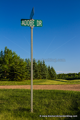
Poking around in northwest Bismarck I came upon this sign for Adobe Drive. Of course I had to stop and grab a photo; I’m a huge Adobe fan since I use Creative Suite products at home and at work for video, audio, animation, graphics…the works.

That got me thinking…if I was a developer and wanted to plat out a neighborhood, it’d be great to put together Adobe CS product names like Illustrator Avenue, Premiere Lane…or something double geeky like Flash Drive!

Of course, there are naming conventions for streets in Bismarck that would disallow that, but it’s still fun to think about.

Yay – Fort Lincoln Trolley resumes operation this weekend


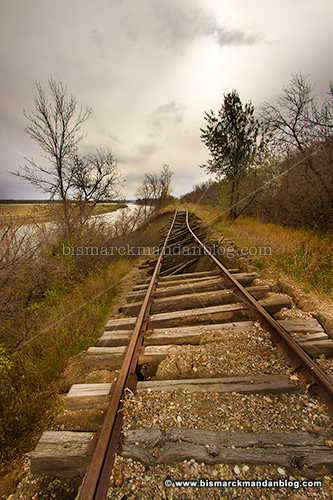
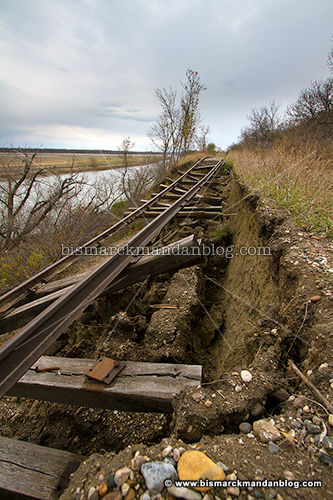
I was pleasantly surprised to find out that the Fort Lincoln Trolley is resuming operations this weekend. Last November I took a hike down the tracks to survey the damage they’d sustained from the flood, and it didn’t look good.


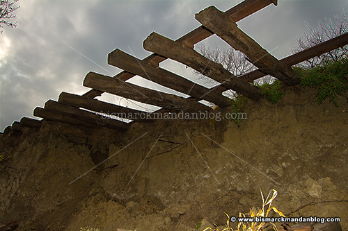
The damage inflicted by the Big Muddy last year is jaw-dropping all along the river’s course, and this is just one of many tragic stories. The hill eroded underneath the track just north of Fort Lincoln.


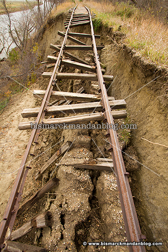
This particular section left a long stretch of rail, along with whatever ties were strong enough to remain attached, literally hanging in open air.


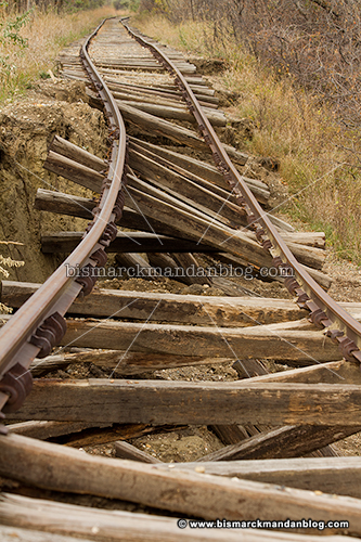
While the rails were not broken, they were certainly bent and in serious need of rescue. I’m so excited that the repairs have been performed given the extent of the damage! The dark spot to the right of the tracks in the upper right portion of this photo is an enormous crack in the earth.


This isn’t the first time that the trolley folks have had to deal with erosion of the hills upon which their track resides; however, I don’t know whether previous damage was anywhere near as serious as this. The hill itself looked like it had some issues, so hopefully they were able to reinforce it as well as the tracks.


As you can see, a large section of the hill simply separated and tumbled toward the river below as the hill was eroded from its base by the overflowing river. I used my monopod as a makeshift jib to suspend my camera in the air over the tracks for this treacherous shot.


View Bismarck-Mandan Blog in a larger map

Central North Dakota was re-imaged last year after the flood waters receded, and that product has made its way to Google Earth. As a result you can see the damage from space. Click “More” then “Zoom Here”. After that use the + on the left to zoom in closer.

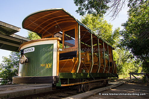
As you can see, it’s a fun ride. It serves as a shuttle back and forth from Fort Lincoln, but it’s also fun to just take a ride down and back if you’re pressed for time. I’m excited to see what it looks like as we cruise over it in style, aboard a new electric Trolley car! It was rolled out for last year but then the tracks failed, so few got the chance to try it. My family will be on it soon!

Prescience…as another one bites the dust

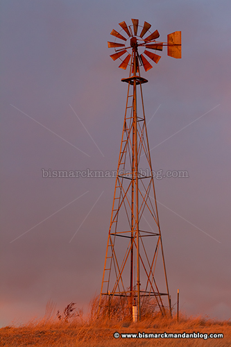
In February the sale of Farmers Livestock, located east of Bismarck, was announced. Along with the auction facility itself, located just off the Expressway on Yegen Road, was included a large parcel of property across the street which was essentially pasture. That parcel was of particular interest to me because it contained the area’s most proximate windmill…one of my favorite photo subjects.

I surmised in this post back in February that the sale of the land could bring with it the demise of this familiar object. As it turns out, I was correct.

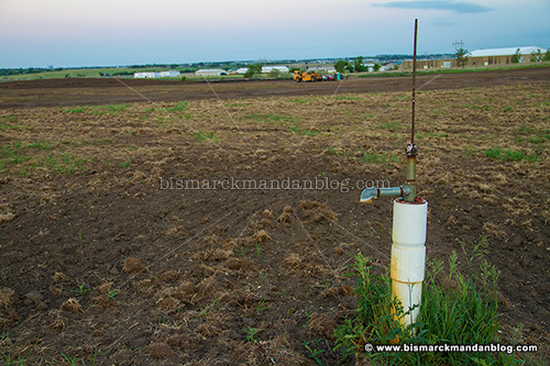
Imagine my surprise and dismay when, on a little photo trip along Apple Creek Road, I found the property was being prepared for development. All that remains of that beloved windmill is the well itself, for however long that may be. It’s marked on my GPS as well as Google Earth, so it’ll be interesting to see what ends up occupying this spot as well as the enormous chunk of land that has been cleared for development.

So, too bad we lost one. Don’t worry about me, though…I’ve got more windmills marked in my GPS and in my head. I’ve got lots more. I’m just glad I had the forethough to bolt out and grab one more series of shots, where it’s bathed in a brilliant orange sunset glow, before vanishing from the local landscape forever.

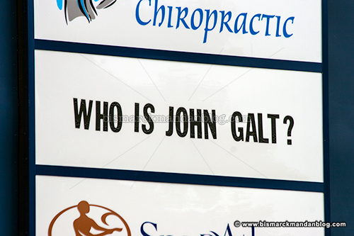
Who is John Galt?

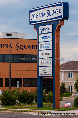
I noticed something interesting when driving by this sign the other day, so last night I made an effort to actually have a camera with me and sought it out once again…

This line from Atlas Shrugged jumped out at me the instant I saw it (the first time). Plenty of rumors abound regarding Mr. Galt, I guess we can add his chiropractor visit or spa appointment to the list. Even revolutionary fictional characters need a massage or an alignment every now and then! 🙂

They missed a piece when they tore down Meriwether’s

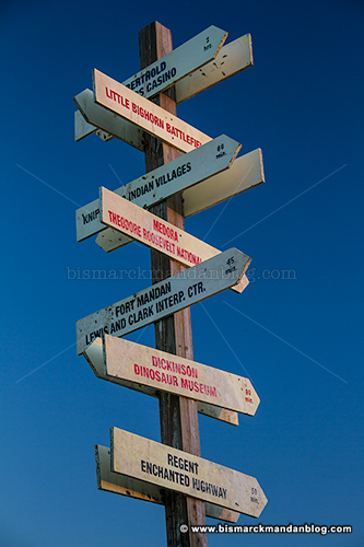
Despite the efforts of my friend and Burleigh County commissioner Mark Armstrong, the city tore down the former Wilton train depot, known for the past twenty-plus years as the Meriwether’s building. It also doubled as the ticket office and souvenir for the various incarnations of riverboat which docked thereby. One interesting feature in the area was the sign you see above, which the Big Muddy decided to relocate far south during its flooding rampage last year.

It was Mark, in fact, who tipped me off to this sign last year already. Obviously it’s taken me quite a while to find the time to get down there and see it up close for myself. I finally did, however, while taking my little boys on a sandy walk to throw rocks into the water and enjoy a warm sunset. Someone apparently found this sign, which had been washed from the vicinity of the Grant Marsh bridge to a sandy stretch well south of the Memorial Bridge, and decided it to stick it into the ground. It’s stayed there ever since, a testament to its resilience.

As far as the plight of the Meriwether’s building goes, I can’t say I have any feelings one way or the other about it. The last restaurant I remember in the building was driven out of business by the closure of River Road when a section slid, and I can’t remember anything ever taking its place. The building is a pretty remote location for a business in all but the warmest few months, so I’m not sure it would have been a good candidate for business even if it had been restored.

I was on board one hundred percent when Phil and Mark were the super-duo on KFYR AM 550 radio and they set about preserving the Provident Life Weather Beacon. That’s a piece of history well known to thousands of people, one which many of us still consult when we want a snapshot of what the weather forecast holds in store. The old depot down by the river? I’m not sorry to say that I doubt many people held the same attachment to it. Sure, there were parts of it that were pretty cool…but one of the best of those has found itself a home about a mile down the river.