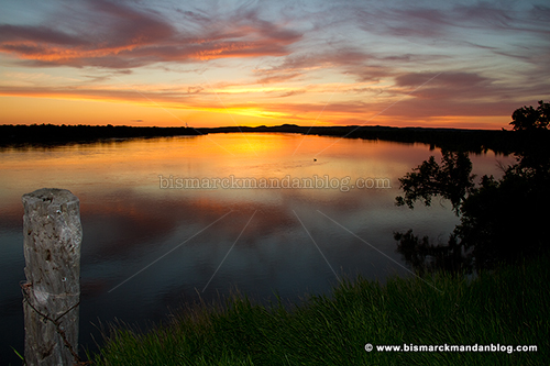
This is a photo from nearly one year ago, taken from one of my favorite Missouri River vantage points: the old fence post at the north end of Double Ditch Indian Village. Pay close attention to this view, because…

…it now looks dramatically different, as can be expected with an astonishing amount of water coming down the valley. All the sandbars, trees, and backwater channels are now simply part of The Big Muddy.

By the way, photos like these just got harder to come by. The reason for that is right here: the ominous ROAD CLOSED sign. Like many scenic areas around Bismarck-Mandan, this area is now off limit to vehicles. Actually, I was surprised to find it open to the public a couple of nights ago when I came up here for some thunderstorm photos. Why, you may ask? Read on.

The cliffs of Double Ditch have been gradually succumbing to erosion for as long as I can remember. Large slabs of dirt occasionally simply fall into the river, and that’s when the mighty Missouri is at normal levels. Now that it’s four feet above flood stage an dmoving at several times its normal velocity, it just got more precarious. I put a camera on a pole and held it toward the edge for this photo, and I have no intention of going back.

It looks like a section of the cliffs further south has collapsed dramatically, opening up a chasm very near to the road. If so, that’s the most plausible reason for the closure. If not, it’s still a wise precaution given the instability of the park’s western edge. That’s not the area shown in the photo above; I didn’t want to walk that far.
By the way, this photo was taken by holding out a pole with a camera on the end – I don’t have a death wish.
I highly recommend against getting curious because these cliffs are likely to recede even further as the river takes its toll. I guess the park is one more casualty of the Flood of 2011, even though it’ll never be under water.


